Tuesday 24 February 2015

Time-travel through pictures

Shelton Street (a tad from the Time Trap Trail, close to Seven Dials)


William Shelton was a holy man and a philanthropist who stipulated in his will that the poor of St Giles should be clothed and educated by his estate. From Shelton’s death in 1661, until 1763, a free school was established in nearby Parker Street which taught 50 local ragamuffins (usually, a child in rags) in English, humanities, classics and good manners, he also left a legacy to provide “the habit of a gentleman” to 20 beggars each year. Given that even the wealthier rookery-dwellers would go around in rags; these 20 must have been the best-dressed vagrants in history!

Until 1877, Shelton Street was known as Castle Street and it marked the unofficial south-eastern fringe of the sprawling St Giles rookery. This area inspired many of Dickens’s depictions of Victorian London’s seedy underbelly. Today, the narrow street, stretching from Drury Lane to St Martin’s Lane still gives clues to its iniquitous past with a number of alleys and courtyards where footpads and highwaymen would have skulked menacingly in the shadows, waiting for the next wealthy merchant to plunder.


Through the fog, Jamie glimpsed small children still out playing, despite the freezing weather. They would appear and then fade into the fog, hopping and skipping along. One group played a game where they rolled head-over-heels.
Jamie and Todd moved through a sea of paupers. Faces peered from everywhere; entire families gathered in the street. Outside one house, a goat stood chained to railings and chickens clucked in small cages. Outside another, Jamie stared up at a large woman barely visible, leaning from an upstairs window, tending to freshly laundered clothes. She hung a sheet over a protruding wooden pole to dry, though it was already grimy from the sooty fog. Jamie soon realised there were many poles along the street with washing fastened and likened them to masses of flags.
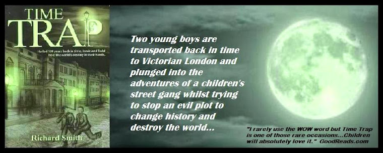
Time Trap

Charles Dickens’s son, Charles Dickens Junior describes it thus:

Here poverty is to be seen in its most painful features. The shops sell nothing but second or third hand articles. 
The street swarms with children of all ages… Public houses abound and it is evident that whatever there may be a lack of, there is no lack of money for drink.”


Shelton Street today


ONCE YOU COMPLETE THE TRAIL AND EMAIL ME THE CORRECT ANSWERS, I WILL DOWNLOAD TO YOU THE PERSONALIZED CERTIFICATE!


The locations featured in the book


Monday 16 February 2015

Time-travel through pictures

Here’s another location on the Time Trap Trail.

Seven Dials


Take Earlham Street (Little Earlham Street back then) opposite the pub and after a short walk, turn left into Tower Court. Look at the school, built in the 1880s, it’s the location of the Holton Gang’s hideout. They dwelt in the basement of a defunct business. 

Now follow the route Jamie and Todd took with Swiper and Patch to Soho Square, where they burgled the house.

(Excerpt from the Trail) 

As I mention in the Trail, Seven Dials is one of my favourite places in London. I sometimes come and visit and stand there, imagining how it was in the mid 1800’s, when criminals dwelled in the neighbourhood, just like the Holton gang in Time Trap. who occupied a basement in Tower Court. 

Henry Holton, the young and powerfully built gang-leader, sat in a big leather chair, hands clasped together. Blond hair pulled back into a ponytail framed his stern face. 
Jamie found himself directly under the light, conspicuous in the glare. Henry picked up a bottle of rum and leaned forward. He stared menacingly at them all. 

Time Trap


The area was described by Charles Dickens in his collection Sketches by Boz, which includes the quote:

The stranger who finds himself in the Dials for the first time…at the entrance of Seven obscure passages, uncertain to take, will see enough around him to keep his curiosity awake for no inconsiderable time…”

The original layout of the Seven Dials area was designed by Thomas Neale in the early 1690s. The original plan had six roads converging, although this was later increased to seven. The sundial pillar was built with only six faces, with the dial itself acting as the seventh. 

Following the successful development of the fashionable Covent Garden Piazza area nearby, Neale aimed for the Seven Dials site to be popular with well-off residents. This was not to be, however, and the area gradually deteriorated. At one stage, each of the seven apexes facing the column housed a pub. Today, only one remains: The Crown. By the nineteenth century, the area had become one of the most notorious slums in London, being part of the rookery of St Giles.


ONCE YOU COMPLETE THE TRAIL AND EMAIL ME THE CORRECT ANSWERS, I WILL DOWNLOAD TO YOU THE PERSONALISED CERTIFICATE!


Monday 9 February 2015

Time-travel through pictures

This is the first in a series of photos of places on and in the vicinity of the Time Trap Trail - a then and now. I will give a brief history of the locations.

Manette Street, (previously Rose Street) Soho.


(Not The Pillars of Hercules, but similar to how it would have looked)

Stop at the Pillars of Hercules pub on the left and take the left, Manette Street, which starts under the pub. You will pass a chapel on the left, Barnabas in Soho. At the end of Manette Street, turn left and cross at the first traffic lights and enter Denmark Street directly opposite. 

(Excerpt from the Trail)

When Jamie and Todd were recruited to the Holton gang, they went to burgle a house in Soho Square with Patch and Swiper.

Jamie tried to swallow but his throat was dry. The darkness seemed to press itself against him. Get a grip, he again told himself. Do the job. And don’t even think about ghosts… but then, he felt a presence - just as he had in Simon’s back room. Beads of sweat broke out on his forehead. Raising one arm to wipe them away, he turned sharply, and found himself staring into a face as pale as death.

Taken from Time Trap


In Victorian times, the short stretch of road was occupied by an organ builder, a maker of coach trimmings (it was close by to Long Acre, where the coaches were made) and a goldbeater who used to beat out ribbons of gold into gold leaf. This would have been supplied to the carriage trade also. The old goldbeater's premises was knocked down for an extension to Foyle's bookshop, (which has since moved). Look out for the replica goldbeater’s sign on the right, as you walk towards Charring Cross Road.

Number 14 was St Anne’s Workhouse from 1771 to 1837. The name of the street was changed after Dr Manette, one of the characters from Charles Dickens’ book A Tale of Two Cities, in the 1890's, who lived in the area.

I like this street with the pub built over it at one end, adjacent to Greek Street, its history, and it provides a link from Soho Square to Charring Cross Road


ONCE YOU COMPLETE THE TRAIL AND EMAIL ME THE CORRECT ANSWERS, I WILL DOWNLOAD YOU THE PERSONALISED CERTIFICATE!


Tuesday 3 February 2015

Get to know London in a fun way!

Once you’ve read Time Trap, you can bring the story to life, by following the Time Trap Trail. The Trail is a self-guided walk, which features London locations in the book. You’ll get to see parts of the capital, few might know, and it may enhance your knowledge of getting around the city. (I recommend you go with an adult to be on the safe side, but make sure they’ve read it too, as I explain the locations related to the story) 

By following in Jamie’s and Todd’s footsteps, you’ll get to see the British Museum, the Holton gang’s hideout, which was in the vicinity of Seven Dials, an area once associated with crime and poverty, the magnificent St Paul’s Cathedral and other places of interest. 

Here's me below, when I accompanied the pupils of Highlands Primary School, on the Trail. Notice they're all wearing their "I'm on the Time Trap Trail" baseball caps. It was a great day.

Take a look at the map, too, all the locations are there.

Happy reading and sight-seeing!